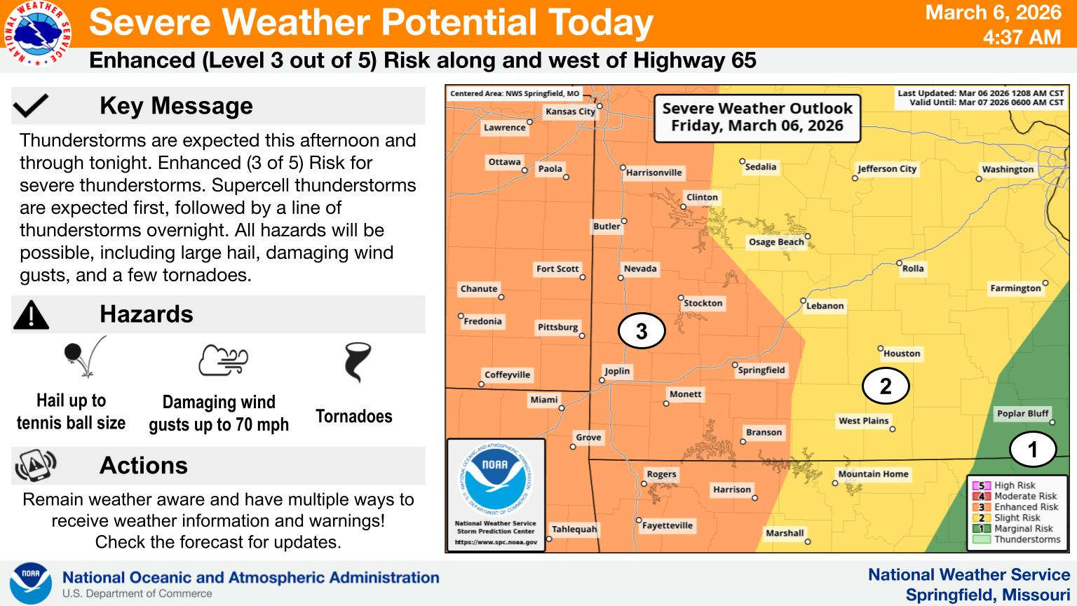
Two rounds of active weather are in the forecast for today and overnight.
According to information released by the National Weather Service, the Lakes Region is at an Enhanced Risk for all modes of severe storms including hail, strong winds, and possible tornados. Areas of heavy rain are also possible.
The first wave will be in the form of supercell thunderstorms which will move through late this afternoon into the evening followed by a squall line that will come in late tonight and overnight as part of a cold front.
The cold front will cool things down for Saturday as the rain moves out with highs in the 50s and lows in the upper 30s before things warm back up for Sunday.
 Crisco, the Goat Known to Table Rock Lake Boaters Dies
 20th FBC Branson Back to School Bash
 Branson Board of Aldermen To Hold a Pair of Meetings Today
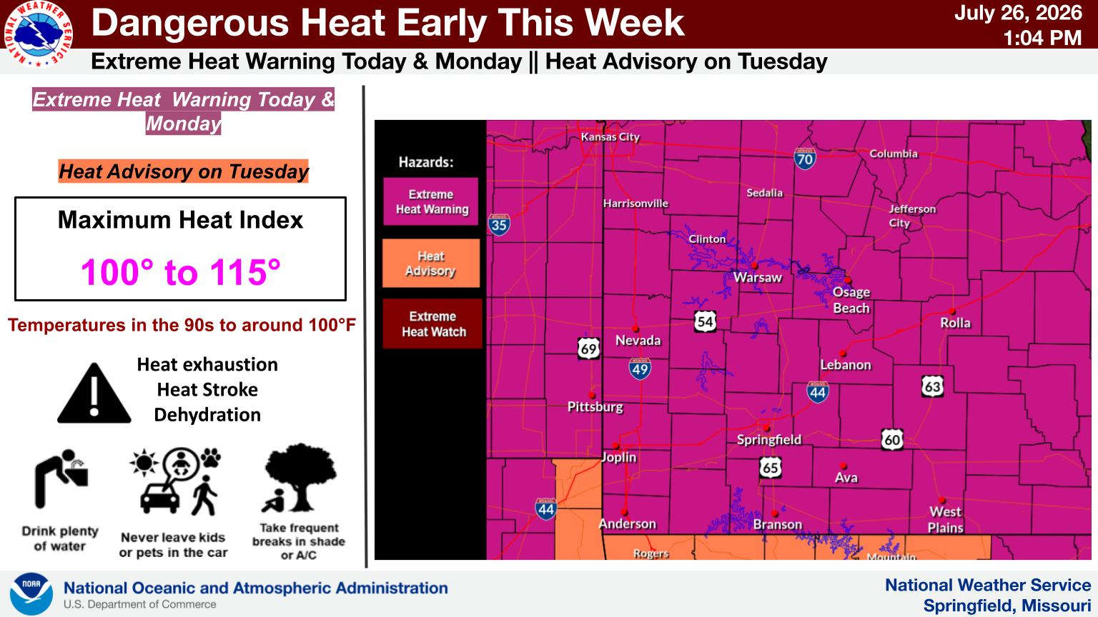 Lakes Region Continue in Heat Advisories, Heat Warnings UPDATE
 Southern Stone County Fire Involved in Water Rescue


