
Today's first day of winter will be the coolest of the week according to the National Weather Service.
Today's highs will be in the 50s, lows in the 30s which is just the start of a warm-up that will go all the way through Christmas Week. Today will also see elevated fire risk conditions with low humidity and winds gusting over 20 MPH.
Temperatures will get into the 60s on Monday then reach the 70s by Tuesday and stay there most of the week, with nightly lows primarily in the upper 40s to mid 50s.
No rain is currently in the forecast for the Lakes Region, which has seen an expansion of drought conditions over the last two weeks.
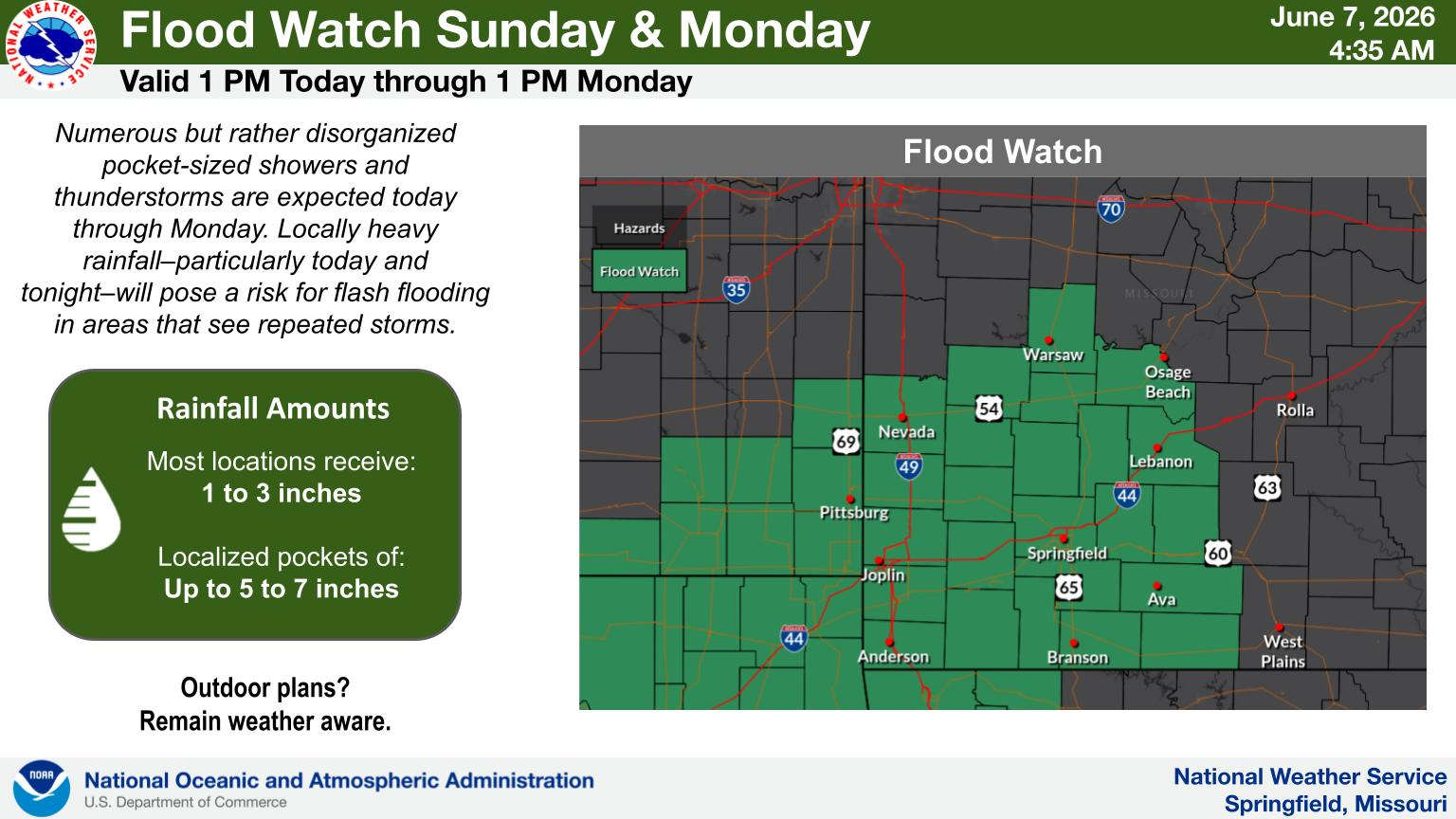 Heavy Rain Possible Today, Monday UPDATE
 DOJ to Award $300 Million to Model Cities Dedicated to Restoring Law and Order
 Transition of Water Meter System in Branson Continues
 CBCO Blood Drives Coming Up In Lakes Region
 Branson Bank Awards Scholarships to High School Seniors


