

The Lakes Region will experience another day of elevated fire risk.
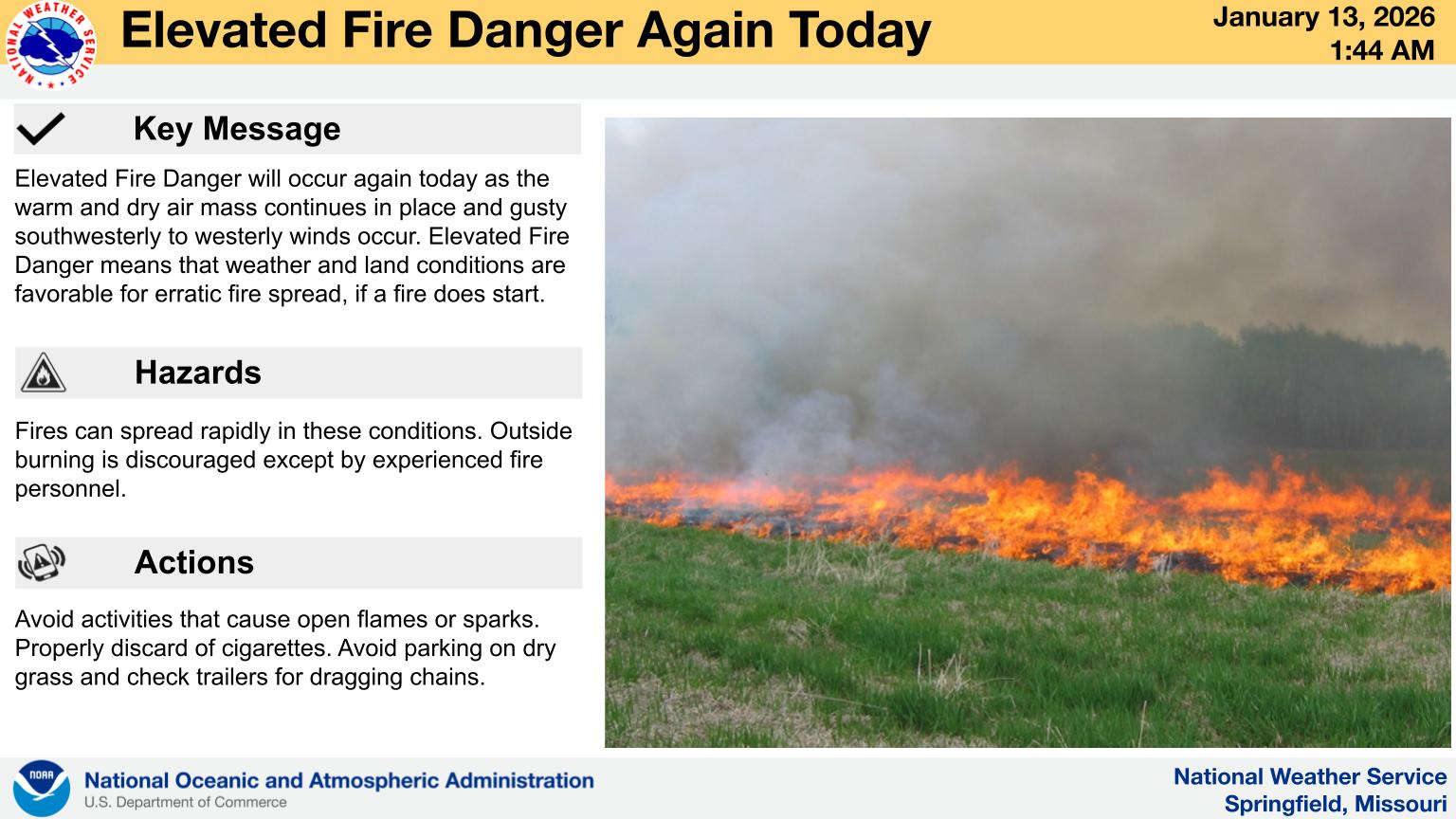
The National Weather Service says Elevated Fire Danger will occur again today as the warm and dry air mass continues in place and gusty southwesterly to westerly winds occur. In these conditions, any outdoor fire can spread quickly and outdoor burning is discouraged.
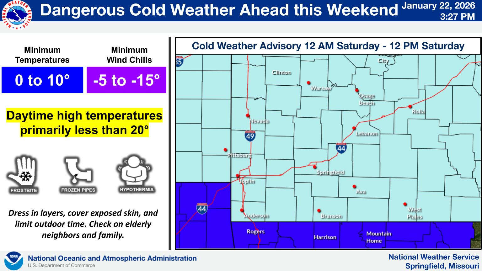
Today’s high temperatures will be in the 60s before a front moves through, bringing a chance of rain overnight and a cool down beginning Wednesday with the temperature range from the 40s during the day to the upper teens overnight. After another brief warm-up, temperatures will bottom out over the weekend with high temperatures by Sunday only in the upper 30s.


 Winter Storm Fern Arrives Tonight
 Reeds Spring School District Announces Formation of an Alternative School
 Weather Updates: Winter Storm, Extreme Cold Warnings Begin Friday