While temperatures are slightly cooler than the end of the week, spring like conditions are still occurring in the Lakes Region.
The National Weather Service Forecast cautions against outdoor burning today, especially in southern Missouri, due to relative humidity dropping below 25%, even though wind gusts are only expected around 20 MPH today.
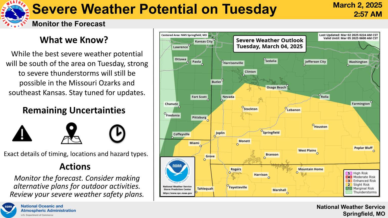
After temperatures between 55-60 today and Monday, a frontal system will bring the chance of heavy rain and severe thunderstorms to the region on Tuesday. NWS forecasters indicate a potential of 1 to 1 1/2 of rain along with a slight risk of severe thunderstorms.
The front will also result in a drop of temperatures by Wednesday with highs in the 40s and lows in the 20s before another warm-up begins on Thursday.
 Arkansas Hot Air Balloon Championship This Weekend
 H.O.G. Rally Underway in Branson
 Rain Expected After Break In Heat
 Update on Accident, Search at Table Rock Lake
 Branson Board of Aldermen Hear Two Proposals For Future Designations and Events


