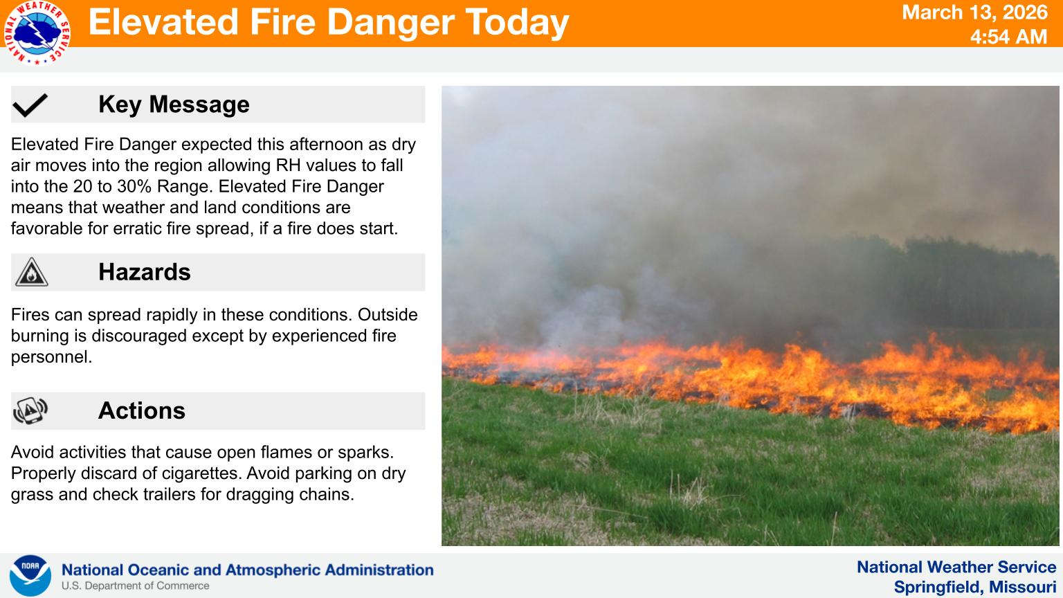
Some of the biggest swings in temperatures of the year are expected over the next week in the Lakes Region.
The National Weather Service says temperatures will be on an upward trend the next couple of days with temperatures in the 60s and 70s. Strong winds today could lead to an elevated fire risk with humidity also at a low level.
A major weather change will happen Sunday as a strong cold front moves through the Ozarks. Temperatures will plummet through the day and could lead to some snow showers late Sunday night.
Next week will start with very cold conditions with lows in the teens and highs in the 30s but 80 degree temperatures are possible by the end of the week.
 Forsyth Fire Department Seeks Information on Vehicle that Hit Fire Station #2
 HCW Acquires Iconic Table Rock Estate
 Branson Aldermen Get Update on Possible Indoor Sports Facility
 Crisco, the Goat Known to Table Rock Lake Boaters Dies
 20th FBC Branson Back to School Bash


