While the strongest storms missed the Lakes Region Wednesday, another two rounds of storms are possible over the next 48 hours.
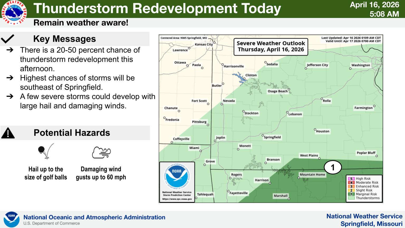
National Weather Service Forecasters indicate the storms will redevelop with areas southeast of a Branson-Harrison Line at a Marginal Risk. Many areas will remain dry today.
The bigger chance for storms will come on Friday as rain chances increase during the day with a Marginal to Slight Risk of severe storms with hail and damaging wind the primary threats. Heavy rain is possible at times with these storms.
The second front will drop temperatures into the 60s by Saturday with overnight lows in the upper 30s to low 40s.
 Duck Boat Pump Fails in Water, Towed Back to Shore
 CDC and FDA Investigate Listeria Outbreak Linked to Recalled Soft Cheese
 UA Northark Hosts “AI in the Classroom Summer Institute” to Empower Educators and Students
 Stone County Officers Assist in Christian County Water Rescue
 Heavy Rain Leads to Swift Water Rescues in Springfield, Wheaton


