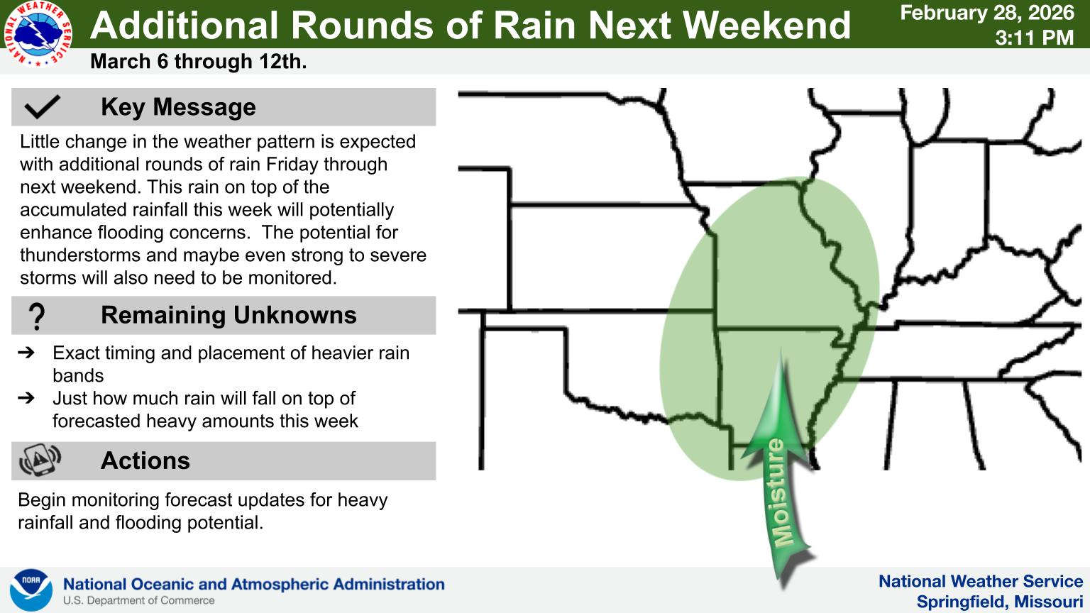
A much needed wet weather pattern is forecast to continue in the Lakes Region.
After some areas got some rainfall on Saturday, another wave of precipitation will move through the Lakes Region this afternoon and this evening. While most will not get heavy rain, some scattered pockets of thunderstorms are possible.
This pattern will continue through the week as Monday will see another round of precipitation move through the region. After a brief break Tuesday, a more general pattern of rain will begin Tuesday night with rain chances continuing through the rest of the week into the next weekend.
Temperatures for the most part will stay warm with highs today and Monday in the 60s then moving to the 70s the rest of the week.
 Heavy Rain Leads to Swift Water Rescues in Springfield, Wheaton
 Showers and Thunderstorms Today, Give Way to Heat This Week
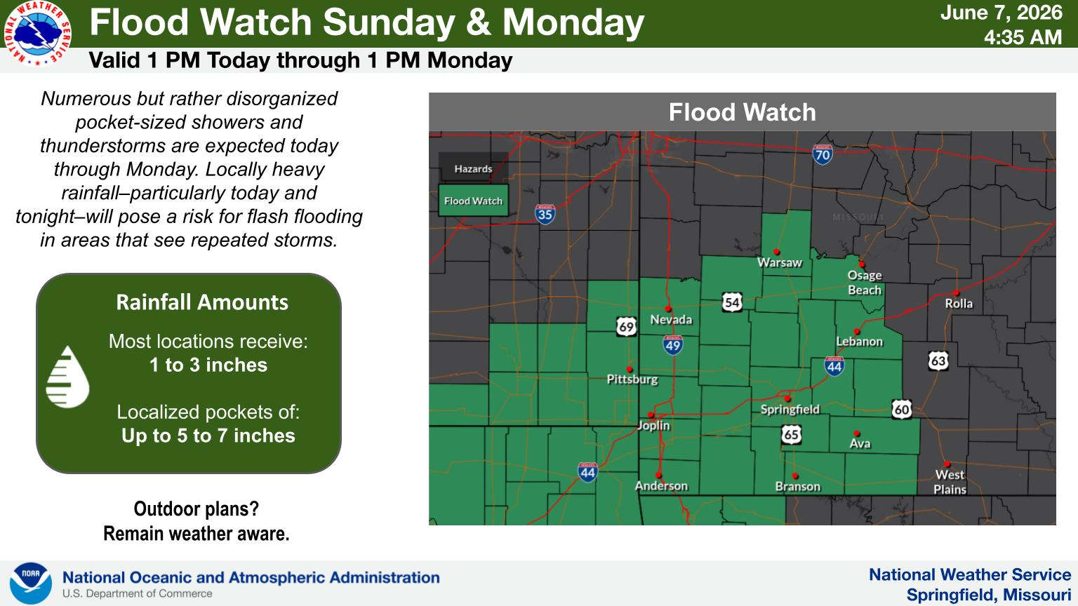 Heavy Rain Possible Today, Monday UPDATE
 DOJ to Award $300 Million to Model Cities Dedicated to Restoring Law and Order
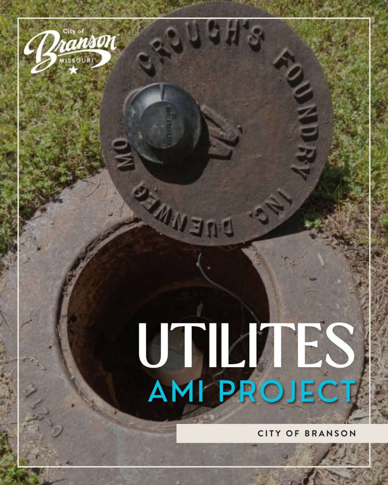 Transition of Water Meter System in Branson Continues


