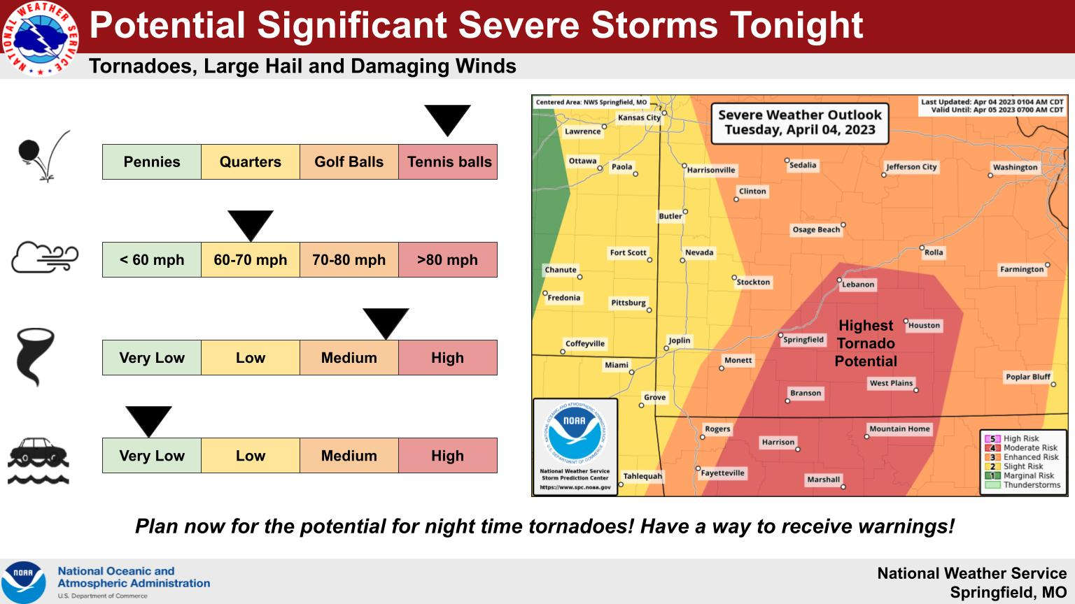
Severe thunderstorm development is possible today with the timing depending on the conditions in the air.
Click below for an interview with Megan Terry from the National Weather Service Office in Springfield:
Original Story:
Ozarks First Meteorologist Jamie Warner says that an atmospheric cap in place may prevent any severe storms this afternoon despite humidity and other conditions that make storm development favorable. Warner says that cap may start to thin during the evening hours which could prompt storms to develop.
The National Weather Service has all of the Lakes Region at a Level 4 out of 5 or a Moderate Level of Storm activity which could lead to several rounds of storms with the highest chance later this evening into the overnight hours. These storms could produce large hail, strong winds and tornados. The storms will move out be sunrise Wednesday with cooler temperatures for the rest of the week.
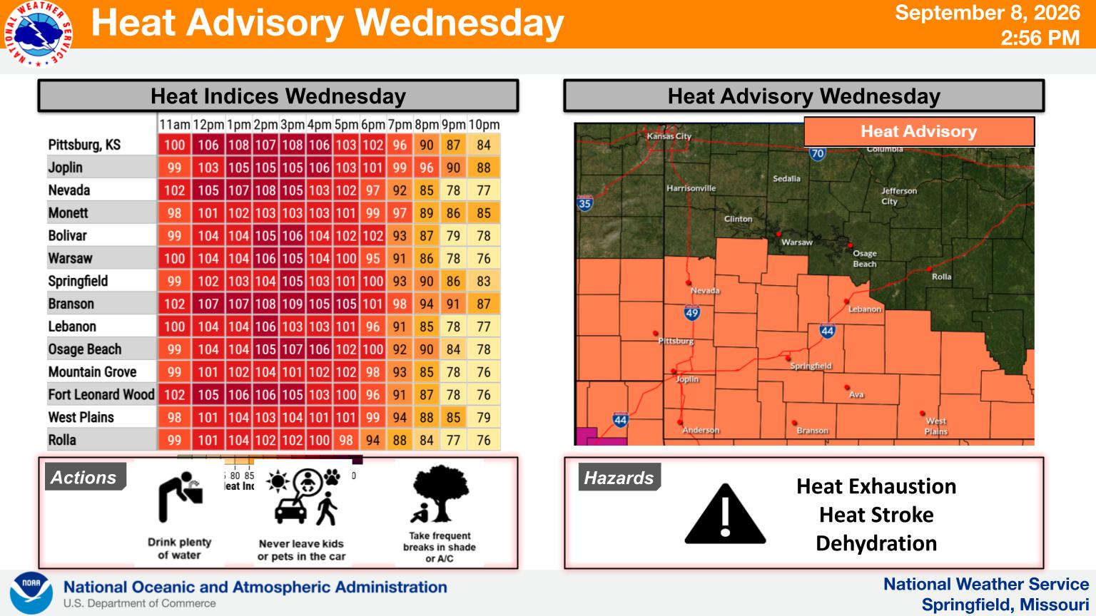 Last Day of Heat Before Break Which Includes Rain Chances
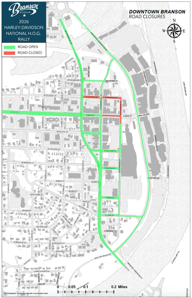 H.O.G. Rally Street Closures Begin Today
 Pedestrian Struck in Parking Lot
 Branson Parks & Recreation Offering Career Readiness Program
 Search Continues for Missing Jet Skier


