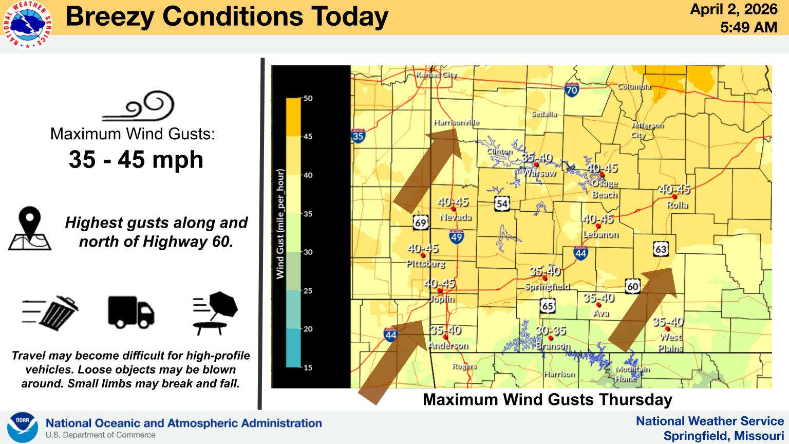
The National Weather Service has raised the Threat Level for Severe Weather for parts of the Lakes Region.
For today, areas east of Highway 65 are at a Marginal Threat for severe storms while areas west will see non-severe but possible strong thunderstorms. Wind gusts are possible above 30 MPH today.
Good Friday has weather forecasters calling for areas north and west of a Branson to Berryville line at a Slight Risk for Severe Storms while a Marginal Risk is in place for areas south and east of that line. Damaging Winds and Isolated Tornados are the primary threats with the storms.
Rain will continue into Saturday before finally giving way to clear and cool conditions on Easter Sunday with lows in the 30s and 40s to start the day before warming into the 60s during the afternoon.


 Branson Fire Chief Ted Martin Celebrated on Last Day on the Job
 Firefighters Rescue Driver of Vehicle That Went Down an Embankment
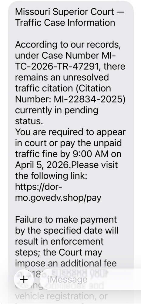 SCAM Warning from Missouri State Highway Patrol
 Saturday Crash Blocks Traffic in Kimberling City
 Rain Rolls Through the Region, Cool Easter Morning Ahead