

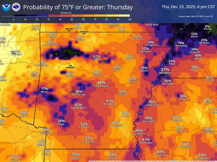
Sunday's first day of winter will be the coolest of the week according to the National Weather Service.
Highs were in the 50s Sunday with temperatures starting in the 30s this morning.
Temperatures will get into the 60s then reach the 70s by Tuesday and stay there most of the week, with nightly lows primarily in the 50s.
No rain is currently in the forecast for the Lakes Region, which has seen an expansion of drought conditions over the last two weeks. Forecasters do predict enough moisture in the air for fog to develop tonight into Tuesday morning.


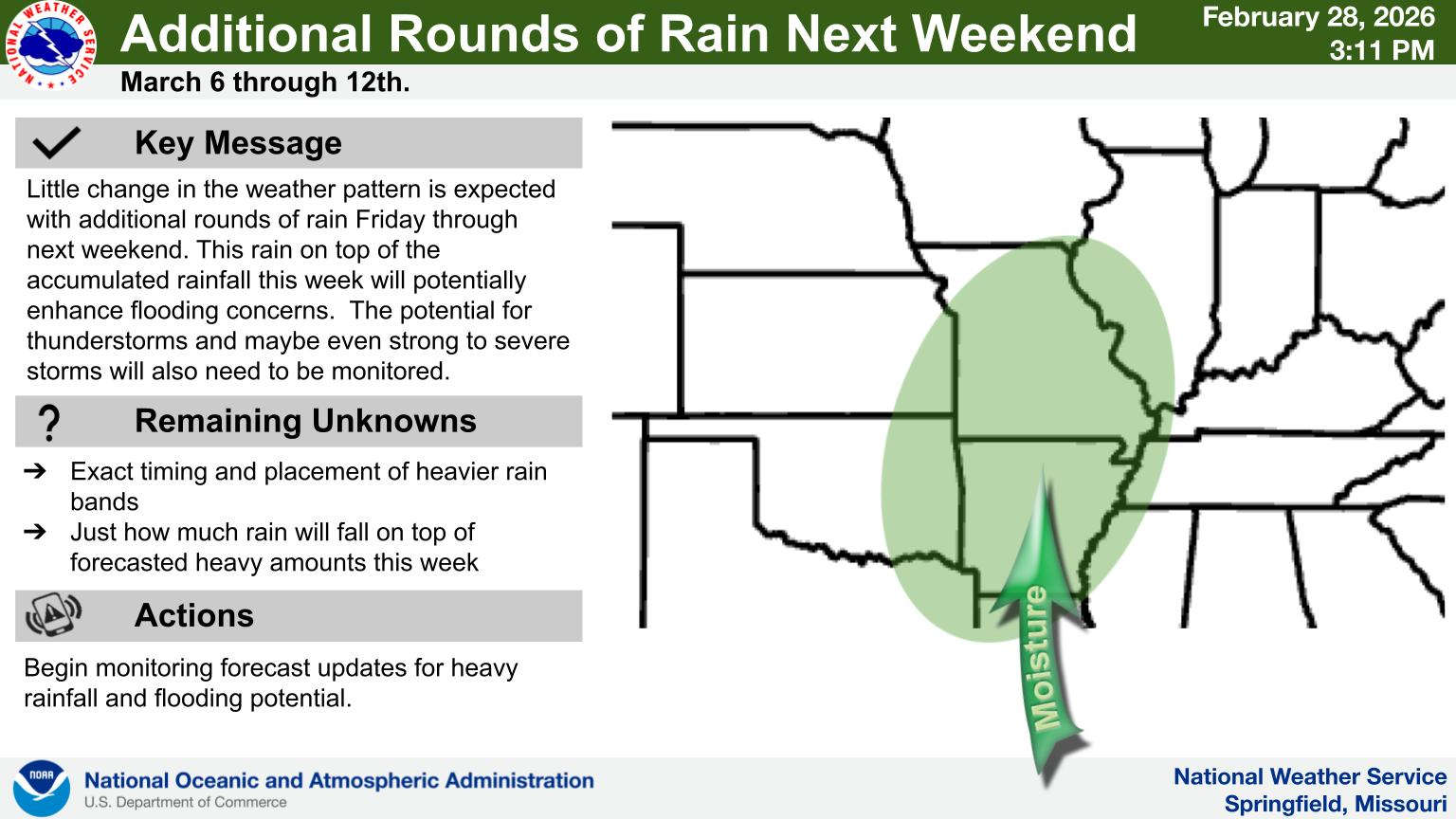
 Rainy Pattern in Place, Severe Storms Possible Later This Week
 Early Voting Last Day, Primary Election Tuesday
 Charges Filed in February Incident Where Man Allegedly Grabbed Police Officer's Rifle
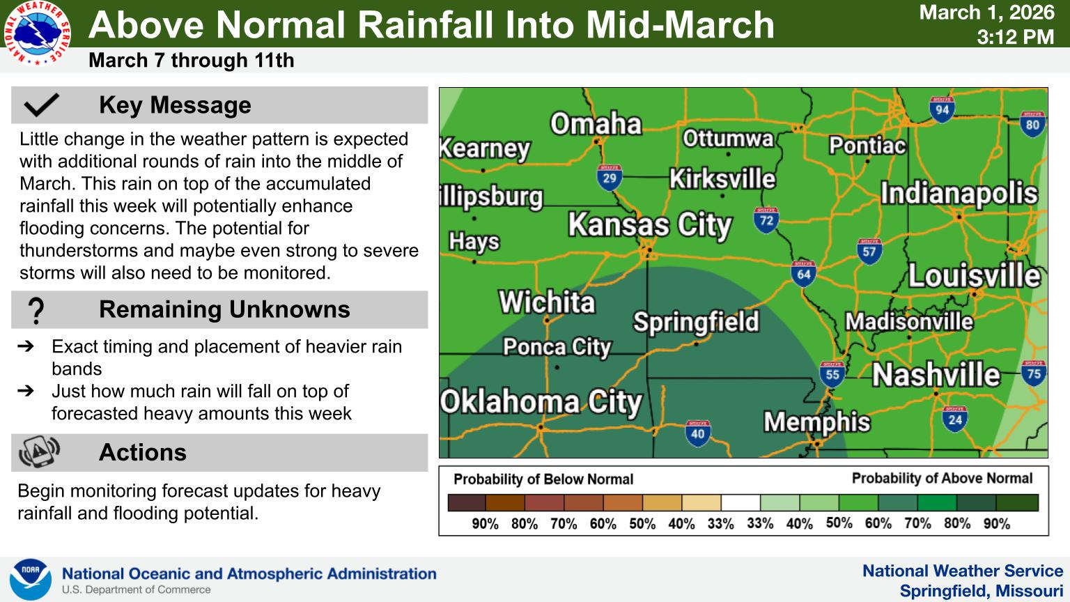
 Rain Pattern Continues Through the Week
 Thousands Attend Service for Fallen Deputies